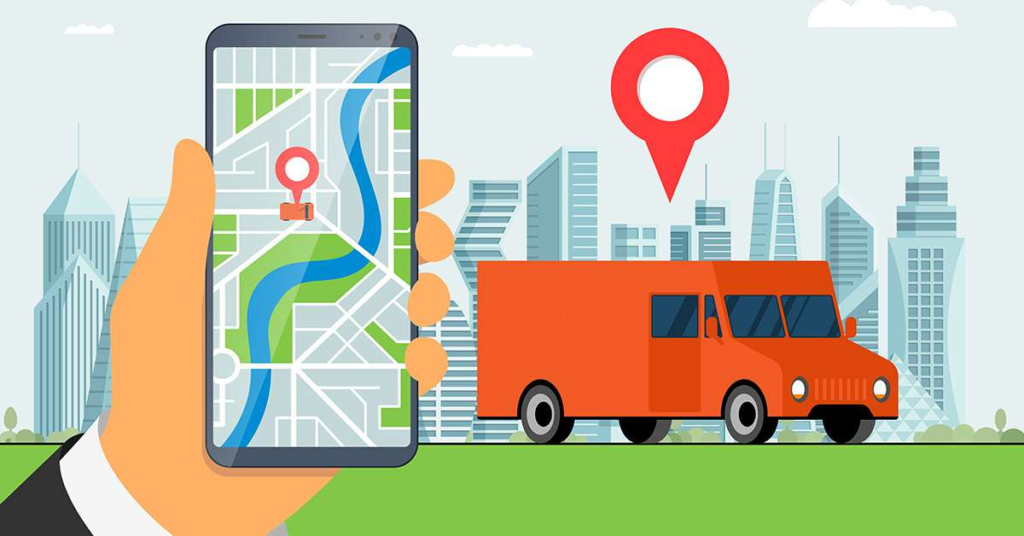

To effectively utilize a GPS tracker, start by ensuring the device is adequately charged and properly activated. Begin by acquiring a GPS signal in an open, unobstructed area to enhance accuracy. Depending on the type of GPS tracker, either attach it securely to the desired object or keep it within a designated space. Once in use, access the tracker’s interface or associated mobile app to monitor the real-time location of the tracked entity. Familiarize yourself with additional features such as geofencing, which enables you to set virtual boundaries and receive alerts if the object moves beyond them. Regularly check the battery status and adjust settings based on your tracking needs. Furthermore, understand the data retrieval process, as some trackers save historical location data that can be accessed later. Utilizing a GPS tracker efficiently involves a combination of proper setup, ongoing monitoring, and leveraging advanced features to maximize its functionality.
How GPS Tracker Works:
The term “GPS tracker” stands for Global Positioning System tracker, a revolutionary technology that has transformed the way we navigate and track objects or individuals. Let’s delve into the intricate details of how a GPS tracker functions.
Global Positioning System (GPS):
GPS is a satellite-based navigation system developed by the United States Department of Defense. It comprises a constellation of satellites orbiting the Earth, emitting signals that are received by GPS receivers to determine precise locations.
GPS Tracker Components:
A GPS tracker is a sophisticated device with several key components:
1. GPS Receiver:
The receiver is the core component that captures signals from satellites. It calculates the distance from each satellite based on signal travel time, enabling the determination of the device’s location.
2. Cellular or Satellite Communication:
GPS trackers often have communication modules (cellular or satellite) to transmit location data to a central server. Cellular communication is more common for real-time tracking, while satellite communication is employed in remote areas.
3. Control Unit:
The control unit processes data from the GPS receiver, manages communication with satellites, and controls the overall functionality of the tracker.
GPS Tracker Operation:
1. Satellite Signal Reception:
The GPS receiver constantly communicates with multiple satellites overhead. At least four satellites are needed to calculate precise coordinates—latitude, longitude, altitude, and the precise time of the signal.
2. Trilateration:
Trilateration is the mathematical process used to determine the device’s location based on the signals received from multiple satellites. By comparing signal travel times, the GPS tracker calculates its distance from each satellite.
3. Data Processing:
The control unit processes the location data and may also consider factors like speed, direction, and altitude. The processed information is then formatted and ready for transmission.
4. Communication:
Depending on the type of tracker, the device communicates its location data via cellular networks or satellites. Real-time trackers often use cellular networks for instant updates, while satellite communication ensures tracking in remote locations.
5. Data Presentation:
The transmitted data is received by a central server or user interface. Users can access this information through dedicated software or apps, visualizing the tracked device’s location on maps.
Applications of GPS Trackers:
1. Navigation:
GPS trackers are widely used for turn-by-turn navigation in vehicles and pedestrian applications.
2. Fleet Management:
Businesses use GPS trackers to monitor and optimize the routes and activities of their fleets, improving efficiency.
3. Asset Tracking:
Valuable assets, such as containers, are often equipped with GPS trackers to prevent theft and monitor their movements.
4. Personal Tracking:
GPS trackers are used for personal safety, allowing individuals to share their location in emergencies.
A GPS tracker operates by leveraging signals from satellites, employing trilateration to calculate precise locations, and utilizing communication modules to transmit data. This technology has diverse applications, from navigation to asset and personal tracking, making it an indispensable tool in various fields.
What are the different uses of gps:
Global Positioning System (GPS) serves a multitude of purposes across various industries, revolutionizing the way we navigate, communicate, and conduct activities. Here, we explore the distinctive applications of GPS in detail:
1. Navigation and Wayfinding:
GPS is the linchpin of modern navigation systems, enabling precise location tracking and route planning. Whether it’s driving, hiking, or sailing, GPS provides real-time guidance, making journeys more efficient and enjoyable.
2. Geospatial Mapping and Surveying:
Surveyors and mapmakers leverage GPS to gather accurate geospatial data. The technology facilitates the creation of detailed maps used in urban planning, environmental monitoring, and land surveying, ensuring precision in geographical information systems (GIS).
3. Precision Agriculture:
Farmers harness GPS for precision agriculture, optimizing resource use. By mapping fields with GPS, farmers can precisely apply fertilizers, pesticides, and water, leading to increased crop yields and reduced environmental impact.
4. Emergency Response and Disaster Management:
GPS aids first responders in swiftly locating and reaching emergency situations. During disasters, the technology is pivotal in coordinating rescue efforts, managing resources effectively, and mitigating the impact of natural calamities.
5. Weather Forecasting and Atmospheric Research:
GPS plays a role in meteorology by providing critical atmospheric data. Scientists analyze GPS signals to measure atmospheric water vapor, contributing to more accurate weather predictions and enhancing our understanding of climate patterns.
6. Time Synchronization:
The highly accurate atomic clocks on GPS satellites make the system indispensable for time synchronization. Industries such as telecommunications and finance rely on GPS signals for precise timing, ensuring synchronization in data transmission and financial transactions.
7. Health and Fitness Tracking:
Wearable devices integrated with GPS offer users the ability to track outdoor activities, monitor distances, and analyze routes. This data is valuable for fitness enthusiasts, healthcare professionals, and researchers studying physical activity patterns.
8. Recreational Pursuits and Gaming:
GPS adds a layer of excitement to recreational activities like geocaching, turning outdoor adventures into treasure hunts. Furthermore, location-based mobile games use GPS to create immersive augmented reality experiences, enhancing the gaming landscape.
9. Wildlife Conservation:
Researchers utilize GPS to monitor wildlife movements and behaviors. GPS-enabled collars and tags on animals provide crucial data for conservationists, helping them understand migration patterns, protect habitats, and conserve endangered species.
GPS has evolved into an indispensable tool, permeating various facets of our lives. Its applications range from the mundane task of getting from point A to B to contributing to groundbreaking scientific research and conservation efforts. The versatility of GPS continues to unfold as technology advances and new innovations emerge.
Advantages and Disadvantages of GPS
Advantages:
1. Precision Navigation:
GPS technology provides unparalleled accuracy in navigation, allowing users to pinpoint their location with remarkable precision. This is particularly beneficial for various sectors, including aviation, maritime, and ground transportation.
2. Time Optimization:
The optimization of routes through GPS not only saves time but also enhances overall operational efficiency. Businesses relying on transportation can experience cost savings and improved productivity by leveraging the time-efficient capabilities of GPS.
3. Emergency Response Enhancement:
GPS significantly improves emergency services by enabling quicker response times. Emergency vehicles equipped with GPS systems can navigate to precise locations swiftly, potentially making a critical difference in life-threatening situations.
4. Location-based Services Innovation:
GPS has paved the way for innovative location-based services, influencing applications such as mapping, weather updates, and targeted advertising. These services enhance user experiences and provide convenience in various aspects of daily life.
5. Optimized Agriculture Practices:
In agriculture, GPS is a game-changer for precision farming. Farmers can optimize resource usage, including water and fertilizers, leading to increased crop yields and sustainable agricultural practices.
6. Wildlife Conservation:
The use of GPS in tracking wildlife contributes significantly to conservation efforts. Researchers employ GPS devices to monitor the movements of endangered species, gather crucial data, and implement effective strategies for wildlife preservation.
7. Geotagging for Content Creation:
GPS facilitates geotagging, allowing users to associate location information with photos and other media. This feature is widely used in social media, travel blogs, and journalism, adding a layer of context to visual content.
8. Scientific Advancements:
GPS plays a pivotal role in various scientific disciplines, aiding researchers in geology, ecology, and climate science. Accurate mapping and data collection contribute to a better understanding of natural processes and phenomena.
Disadvantages:
1. Signal Vulnerability:
GPS signals may face interference from obstacles like buildings, mountains, or dense vegetation, leading to inaccuracies in location tracking, especially in urban areas or heavily wooded regions.
2. Overreliance on Technology:
Excessive dependence on GPS navigation can result in a decline of traditional navigational skills. In situations where GPS is unavailable or malfunctions, individuals may struggle to navigate using alternative methods.
3. Privacy Implications:
The widespread use of GPS raises concerns about privacy, as constant location tracking can be exploited for unauthorized surveillance. Safeguarding personal privacy becomes crucial in the face of advancing GPS technology.
4. Initial Investment Costs:
The implementation of GPS technology, especially on a large scale, involves substantial initial costs. This includes the purchase of GPS devices, infrastructure setup, and training personnel, posing a financial barrier for some entities.
5. Power Consumption Challenges:
GPS-equipped devices tend to consume more power, impacting battery life. This is a concern for mobile devices and vehicles relying on GPS navigation, necessitating frequent recharging.
6. Susceptibility to Spoofing and Jamming:
GPS signals are vulnerable to spoofing (false signals) and jamming (interference), which can be exploited for unauthorized activities or to compromise navigation systems.
7. Environmental Impact:
The production and disposal of GPS devices contribute to electronic waste, raising environmental concerns. Sustainable practices and proper recycling measures are essential to mitigate the environmental impact of GPS technology.
GPS technology offers unparalleled advantages in navigation, efficiency, and safety, it is crucial to address challenges related to privacy, signal reliability, and environmental impact for responsible and sustainable usage.
FAQs
Can GPS trackers be used in all types of vehicles?
Yes, GPS trackers can be installed in various vehicles, including trucks, cars, and motorcycles.
Is it legal to use GPS trackers on personal vehicles?
Laws regarding GPS tracker usage vary. Always check local regulations to ensure compliance.
How often should I update the GPS tracker software?
Regular updates are essential to ensure the tracker functions optimally. Check for updates at least once a month.
Can GPS trackers be disabled or tampered with?
While some attempts to tamper with GPS trackers are possible, modern devices come with anti-tampering features.
Do GPS trackers work in remote areas?
GPS trackers may experience signal issues in extremely remote areas with limited satellite coverage.
Conclusion:
In conclusion, mastering how to use GPS trackers can significantly benefit truck owners and fleet managers. For reliable and advanced GPS tracking solutions, consider Qodenext – a trusted brand committed to enhancing your tracking experience. Optimize your logistics, improve security, and stay ahead in the fast-paced world of transportation with Qodenext.